The apple firm is currently updating the card of its navigation application in France. To do this, she uses her car fleet specially provided for this purpose. These areSubaru Imprezawhite equipped with the famous Lidar on the roof, the remote sensing deviceResponsible to scan the environment at 360 degrees, thanks to thousands of laser beams.
Back in France
© 01Net
After crossing French roads in May 2023, THESubaruApple are back. Apple indicates in this regard on its site:
Apple performs field studies all over the world, using vehicles, in order to recover data that will be used to improve the plans application as well as the 360º seen functionality. We will also have to revisit certain places periodically in order to collect new data to keep high quality plans up to date.
When will Apple go to your city?
The new updating of the Plans card startsFrom February 20 in Provence-Alpes-Côte d'Azur and ends on May 14, 2024 in Brittany. Here is the dates of passage for each region:
- Auvergne-Rhône-Alpes: March 02, 2024-April 10, 2024
- Burgundy-Franche-Comté: March 08, 2024-April 16, 2024
- Brittany: April 13, 2024 - May 14, 2024
- Center-Val de Loire: March 10, 2024-April 03, 2024
- Corsica: February 23, 2024 - March 19, 2024
- Grand Est: March 15, 2024 - April 20, 2024
- Hauts-de-France: March 30, 2024-May 03, 2024
- Île-de-France: March 17, 2024-April 30, 2024
- Normandy: March 31, 2024 - April 30, 2024
- New Aquitaine: February 24, 2024-March 28, 2024
- Occitanie: February 24, 2024 - March 20, 2024
- Pays de la Loire: March 17, 2024 - April 19, 2024
- Provence-Alpes-Côte d'Azur: February 20, 2024-March 22, 2024
In addition to cars, you can also cross operatorsApple Planspedestrians, looking for hikers. The latter allow Apple to collect even more precise data on the premises where these agents pass.
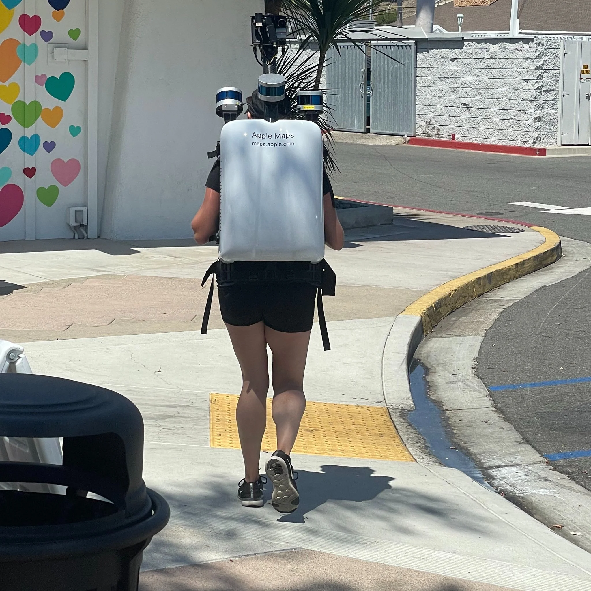
© [X] / @JoannaStern
How does the Lidar work?
As mentioned above, the LIDAR scans the environment at 360 degrees thanks to thousands of laser beams. More specifically, it measures the distance between the terrestrial surface and the sensors, and then create 3D representations of the swept area. Small hic, however, Lidar systems can providea very detailed 3D representation of an environment,But offer arendered in black and white. The firm therefore completes the system withcameras that will add the colorsAnd the textures to his cards.
See also:

i-nfo.fr - Iphon.fr official app
Equal: AG Tescience