While thehistoric release of Apple's mixed reality headsetfast approaching, we learned today that the firm has just filed a patent concerning a possible functionality for iPhone and iPad. This involves reading the environment in augmented reality.Cupertino engineers also collect certain user data(anonymous) from Apple Plans to power this feature.
Augmented reality refers to the integration of virtual elements into a real environment. In the case of Apple's patent, which also bears the numberUS 20230417567 A1, it would be a question of a functionality offeringthe possibility of finding places of interest around us live, then suggest an optional route.
Googlealso already includes a similar functionality calledLensInMapswithStreet View : «Thanks to Lens in Maps, you just need to navigate like in Street View, then observe a building so that it reveals all its secrets to us. »
The Apple firm innovates, but it’s complicated
On the Apple patent side, here is a visual sketch presenting the functionality:
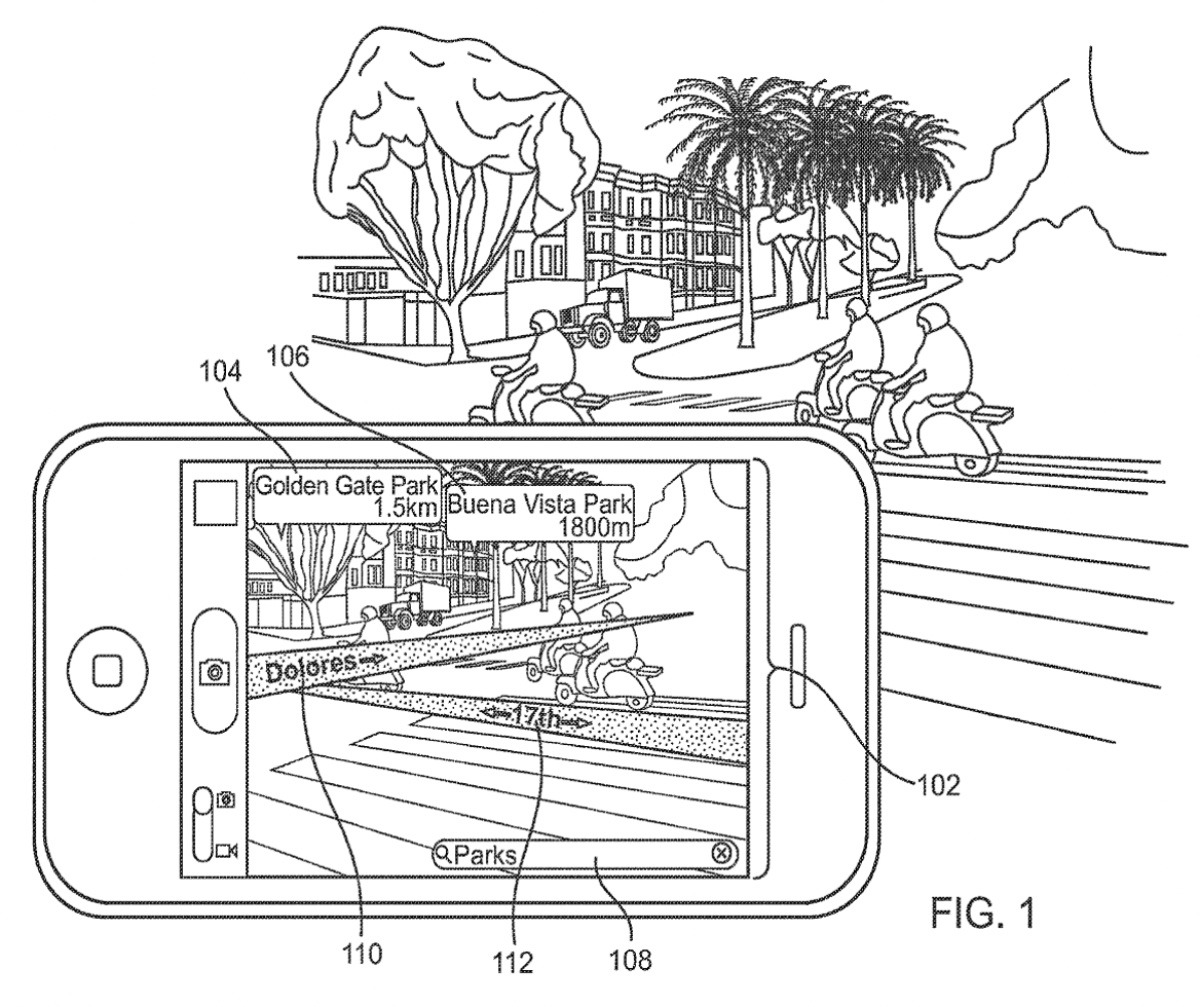
© Apple
The difference withLensInMapsis thatApple uses the device's camera directly to extract data from the captured environment.Googleuses on his sideStreet Viewto achieve this, it therefore does not require access to the camera. Its tool can also be used by any device.
The technology explored by Apple, however, seems more complex to implement given that it is areal-time environmental analysis in augmented reality..Thatthanks to the device's camera, as well as a "portable communication device»capable of detecting«a geographic position and camera direction».
The firm would also have explored an option to offer routes in augmented reality, but it seems that this is complex to implement. For the moment, Apple is considering the possibilityto redirect users to a classic navigation application like Apple Maps,once they have found a place of interest through augmented reality.
Here is Apple’s translation of the patent summary: “A portable communications device can capture and display a video feed in real time. The portable communication device detects a geographic position and a camera direction of the portable communication device. A route is identified from the geographic location of the portable communications device to a point of interest. The captured video stream is visually augmented with an indicator indicating the direction to follow to the point of interest. The indicator is superimposed on the video stream captured in real time.»